Great Divide Trail Thruhike | Section A - Trail Report
A Rocky Mountains Timelapse
Start: Monument at the Canada/U.S. border in Waterton Lakes National Park, AB
End: Coleman, AB
Distance: ~150 km / 91 miles
Elevation Gain: ~ 5.600 m / 18.370 ft
Alternates: Rowe Alternate, Barnaby Alternate, Lynx Creek Alternate
Keywords: Windy - lots of lakes - well-maintained trail - social
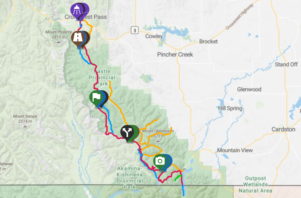
Section A of the Great Divide Trail (Source: FarOut).
Day 0: Thumbs up: We’re going to Waterton!

Not our best sign… The marker was out of ink!
After leaving the car in Calgary, trail angel Melissa dropped us off in High River, from where we hitchhiked to Waterton National Park.
Trail Angels on the Great Divide Trail
Yes, you read that correctly: There are trail angels on the GDT! Far and few between, because of the remoteness of the trail, so go and connect with them on the GDT Trail Angel Facebook page!
Our final hitchhike took us all the way to the heart of the park. There, Waterton Lake invited us for a swim. In the Tamarack outdoor store, we bought an emergency blanket for its double use as a ground sheet). After our little shopping spree, we headed for the park’s campground. The park rangers know about Great Divide Trail hikers and save some camping spots for late-arriving hikers like ourselves. Gratefully, we paid 11 CAD for a campsite and had a nice, hot shower in the washrooms (Canadian for toilet).
Day 1: Waterton Town - monument - Alderson Lake (19 km)

The first days on the GDT (Source: FarOut)
We woke up to greet a misty and magical morning. The first leg of the hike would be 6 km to the Canada/U.S.-border, where we would tag the monument and then simply turn around. A pleasant, well-defined trail along Upper Waterton Lakes brought us to the border.
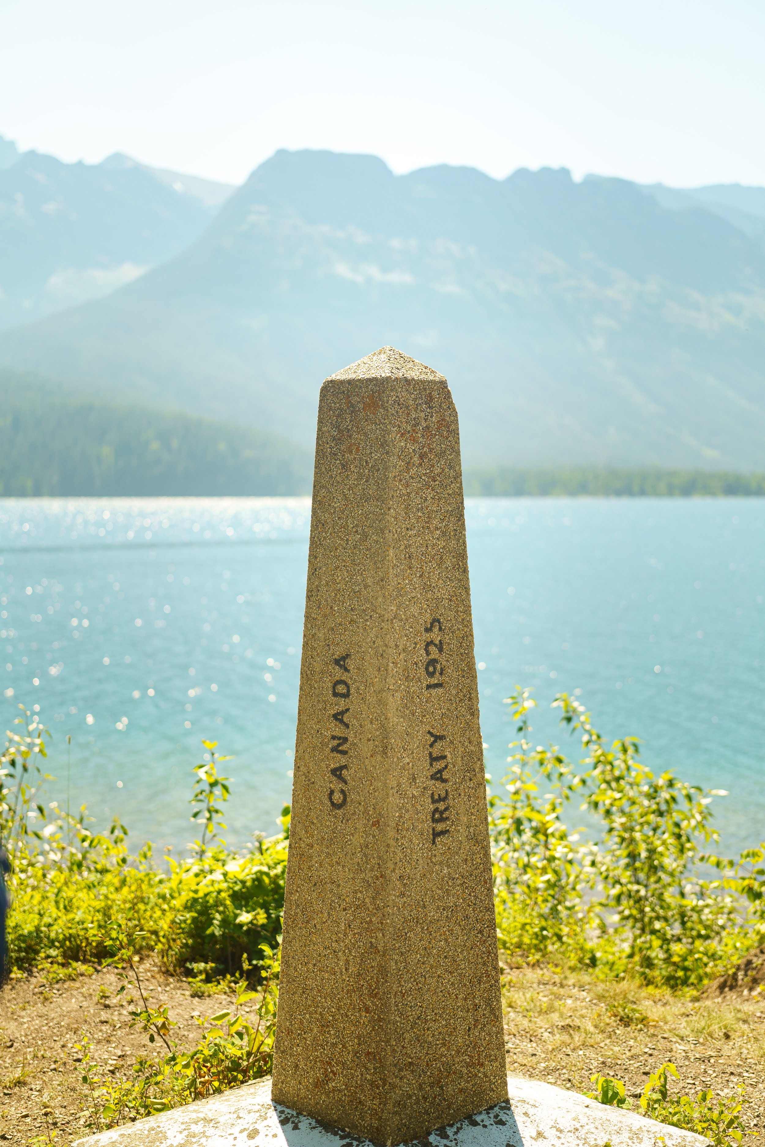
The border monument
Accompanied by ripe, red thimbleberries and tourist boats, we found the border monument, existing of 1 metal and 1 stone pillar.
Standing on the dock, we witnessed two countries collide into one. The lake, ignorant of any borders, is neatly divided into Waterton National Park and Glacier National Park, the world’s first International Peace Parks. In nature, borders seem even more ludicrous. Ryan said his goodbyes to his country of stripes and stars and we started walking North on the Great Divide Trail.
Walking back, we met fellow thru-hiker, Rudy, also known by his trail name Chef. He makes beautiful videos of the trails he hikes. You can find his videos on Youtube.
The start of the Great Divide Trail can be pretty crowded. That is because Waterton town is accessible by car. Many people gather there to paddleboard, eat ice cream, or watch wildlife. Of course, we too joined the party, went for a swim, and ate some good poutine. When we finally left the pleasures of town behind to continue hiking the Great Divide Trail, we passed by the beautiful Cameron Falls.

Reenactment of Baby Simba in The Lion King.
Further away from town, uphill, the crowds soon thinned out. We walked through fireweed and half-burned trees until we reached our destination for the day. However, expecting a full campground, Alderson Lakes was entirely ours that night. Odd, since we booked the last camping permit… Turns out that empty campgrounds would be a repeating pattern in the parks.
Day 2: Alderson Lake - Akamina Campground (15 km)
The first night on the trail was a rather exciting one: My sleeping pad had a hole in it! We fixed it up with a Therm-A-Rest repair patch - lucky for me, Ryan carries a bag full of Gorilla Tape, repair patches, Super Glue, and other useful knick-knacks.
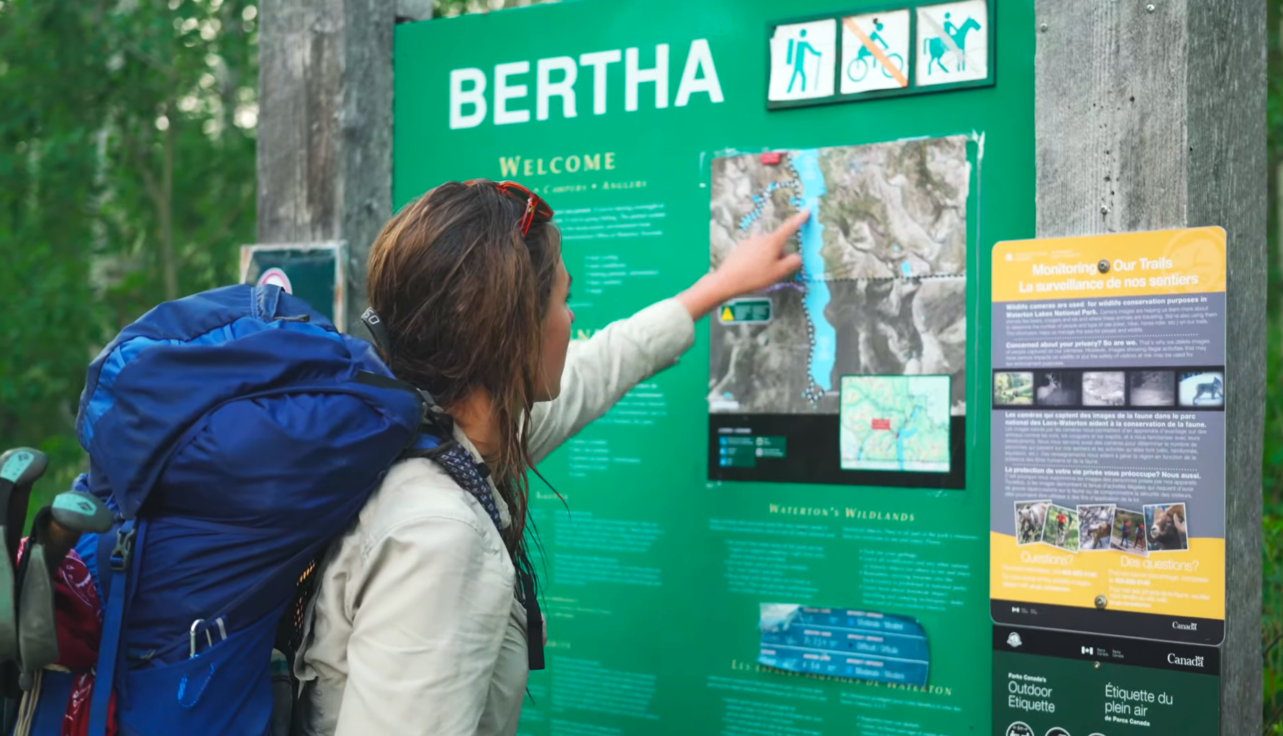
The beautifully maintained trail continued and climbed up to the lower and upper Carthew Lakes. We spotted our very first Common Loons on the Great Divide Trail. They really are fond of large alpine lakes. Blue, pristine lakes and windy weather: Waterton Lakes in a nutshell.

We met many other hikers that day, amongst them Jeff, who was section hiking the Great Divide Trail with a harmonica. He was very knowledgeable about the Great Divide Trail and a proud familyman.
After a refreshing dive into Cameron Lake with Jeff and Chef, we made our way to Akamina campground. This time, it was a full house!

Bear lockers and wooden picnic tables accommodated all GDT hikers and we spent a lovely evening, chatting, eating, and journaling.
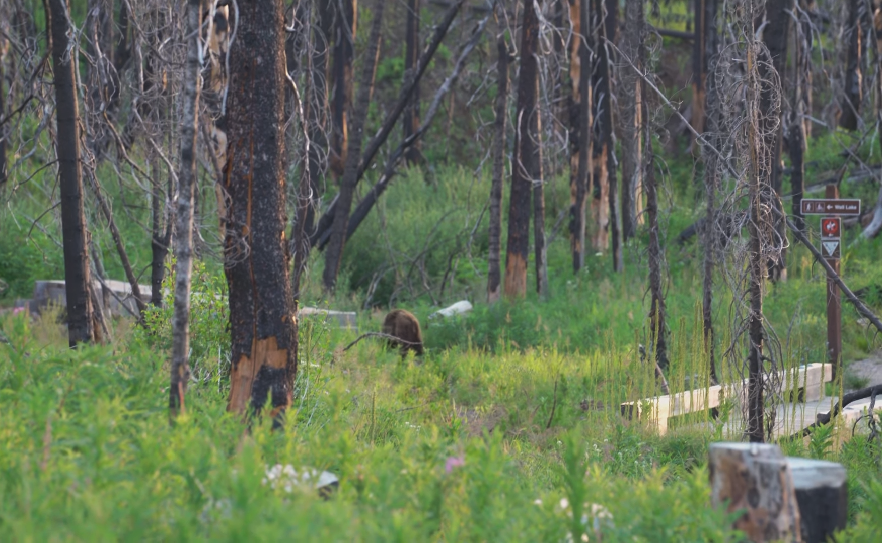
A grizzly youngster even tried to join the party, before making his way up the hill and beyond.
Day 3: Akamina Campground - Lone Lake Campground (20 km)
Today, a serious decision lay in front of us: To Rowe Alternate or not to Rowe Alternate? We had heard many frightening stories of this unmaintained cross-country adventure, but we learned from the GDT webinars that it was a detour worthwhile. The only question remained: Are we ready to face the windy, challenging ridge walk? “Oh shoot, we’re on the Great Divide Trail, that’s what we’re here to do!” we exclaimed and started scrambling up the hill.

After a 3-hour heavy climb, we made it to the top of the ridge. But right before we could seal our victory, we were B-L-O-W-N away by the wind! Having no shelter whatsoever, we were forced into rain gear, gloves, hats, and sunglasses. We looked like Neo and Trinity from the Matrix and had to fight for every step we took. After 2 km, we decided to take the blue pill and bail!

Scrambling down
But adventure time was far from over! To get off the ridge, a snow cornice and a super steep, long scramble down awaited us. We stumbled, cross-country style, down the mountain slope to Rowe Lake. There, Ryan taught me how to “ski “ down gravel slopes, without skies, that is…
It was past noon by that time and we still had some ways to go. Back on the official Great Divide Trail, we climbed to Lineham Ridge, a pretty spectacular viewpoint. Once we turned around the corner, the wind chased us down the trail pretty quickly. The rest of the afternoon, we waded through scorched forests and grave burn scars. We had a permit for Twin Lakes, but after our windy and rather lengthy escapade, our tired feet could carry us no longer. At dusk, we set up camp at Lone Lake instead and enjoyed the silence.

The bright side of burns
Burn areas are fertile grounds for fireweed and new grasses, making room for butterfly and insect families. Every down has an up...
Day 4: Lone Lake Campground - Jutland Creek (20 km)
The next morning, Ryan and I slept in until 7:30 - yikes! We never were early birds, and getting up usually involves a lot of snoozing and coffee. Our morning eventually evolved into a heart-warming and honest conversation with fellow hikers Lynnie and Sophie. Mother and daughter, exploring their strong connection and shared admiration of the natural world around them.
Sophie spoke of the abundance of flowers on the Great Divide Trail, and it couldn’t be more true. Day four absolutely spoiled us with flower-filled fields, the exquisite perfume of newly-sprung buds and bees buzzing around them.

We met the first horse lords on trail, too! A family of four was on their way to Lone Lake Cabin. Our respect for equestrians - or horse lords - yes, we listened to LOTR audiobooks - increased with tenfold during this journey. It has become somewhat of a dream of our own. One day!

Our lunch spot was at Twin Lakes, where Ryan had a cold swim session. The weather soon turned and we prepared for the worst. We climbed a ridge and left Waterton Lakes National Park behind us. In the distance, big black smoke plumbs rose up and we could smell the wildfire. Pretty scary to experience a fire this way, makes you think of the scale of everything.

The smoke turned orange-red…
and soon, every notion of a horizon was wiped out. So we hiked on, into the void. I wasn’t comfortable, but Ryan reassured me of our safety. We entered the realm of Castle Provincial Park, where the sky cleared up and visibility returned. We camped at Jutland Creek with Lynnie, Sophie, and their friend Barb.
Day 5: Jutland Creek - Grizzly Lake (16 km)

Calling for help looks like this!
Day four turned out to be quite interesting. Today was the day of the notorious La Coulotte Ridge and the even more infamous Barnaby alternate! Clueless of what lay ahead of us, we started our day over Scarpe Pass and along the steep ridge to the peak of La Coulotte. After two false summits and lots of cursing, we finally made it to the real deal! Mind you, this ridgeline is pretty exposed and does not have much water or room for mistakes. We hoisted ourselves onto the peak and signed the trail register. While recovering, don’t forget to look around you: There are sublime 360° mountain views.
Next up? That would be the Barnaby Alternate - the very word alone still gives me the chills. This alternate would prove to be a time-consuming, challenging, route-finding scramble. Luckily, thanks to the GDTA members, there are flags around the scariest bits.
I wrote the following excerpt in my diary:
“The alternate totally wiped me out. Following a game trail, sometimes fully disappearing, then popping up again after some time. Ridgewalking is what it was. Up and down the hill, up and down the next one - I lost count after a while. I still felt quite cheerful, but when we consulted the map and I saw that we barely managed 1 mile per hour, I broke down. Lesson learned: Some things take time and you cannot fight it. So don’t try.”
Alternates take time, patience, and some courage, too. This was something I heavily underestimated. But I am very grateful for the experience and now, I find myself a lot stronger, more capable, and knowledgeable in rough terrain.

Sliding down doesn’t always come easy.
We skied (read: tumbled) down the gravelly trail towards Grizzly Lake, home to of a pair of Loons and, according to multiple wooden constructions, the occasional bushcrafter. Barb, Sophie, and Lynnie came rolling into camp not soon after and they too slept on the shores of Grizzly Lake.
Day 6: Grizzly Lake - Lynx Creek (34 km)
Time for a big push today. We were ready to get off the ridge and back to the trail.

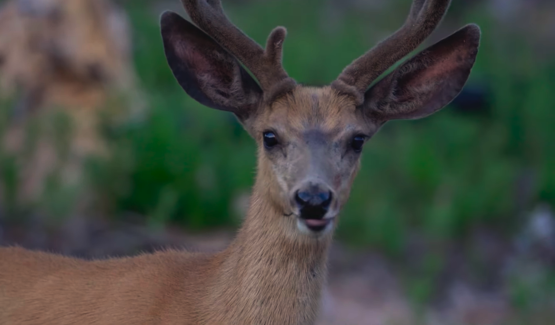
An early-morning deer encounter, one of many.
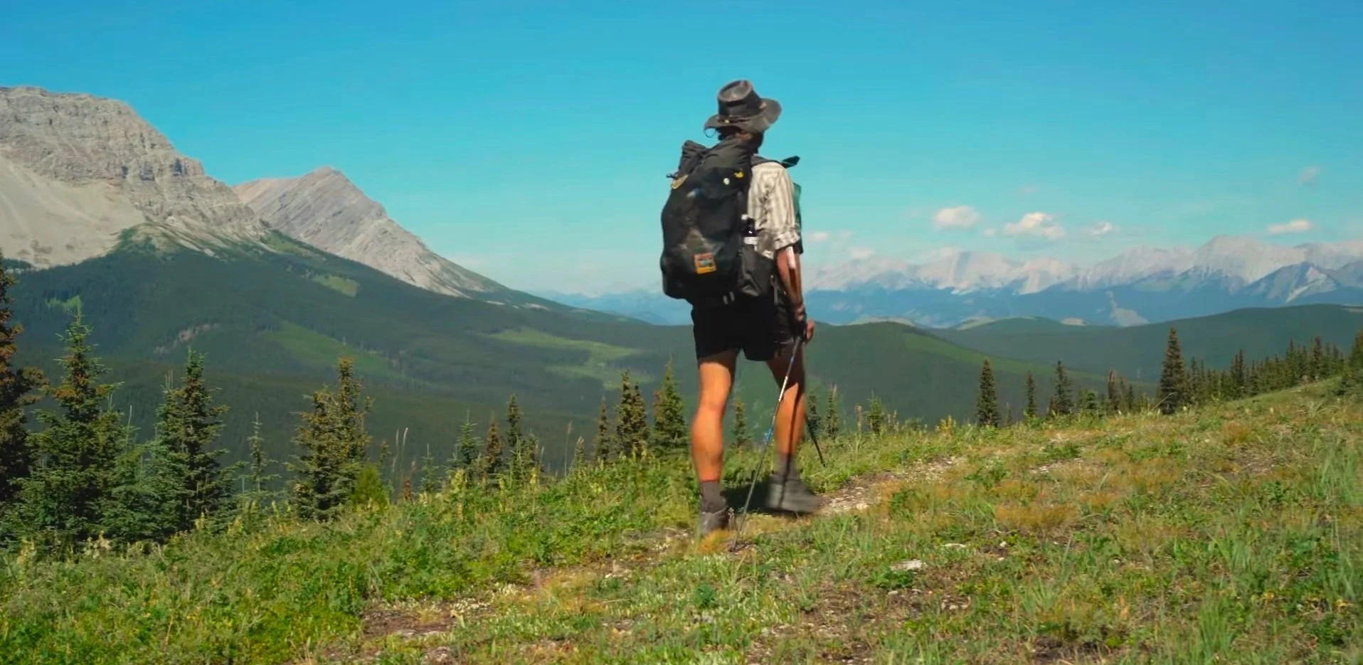
After one week, your trail legs start to show. They grow stronger, and your pace picks up. Hiking up and down is part of your every day now, and you start to get the hang of it.
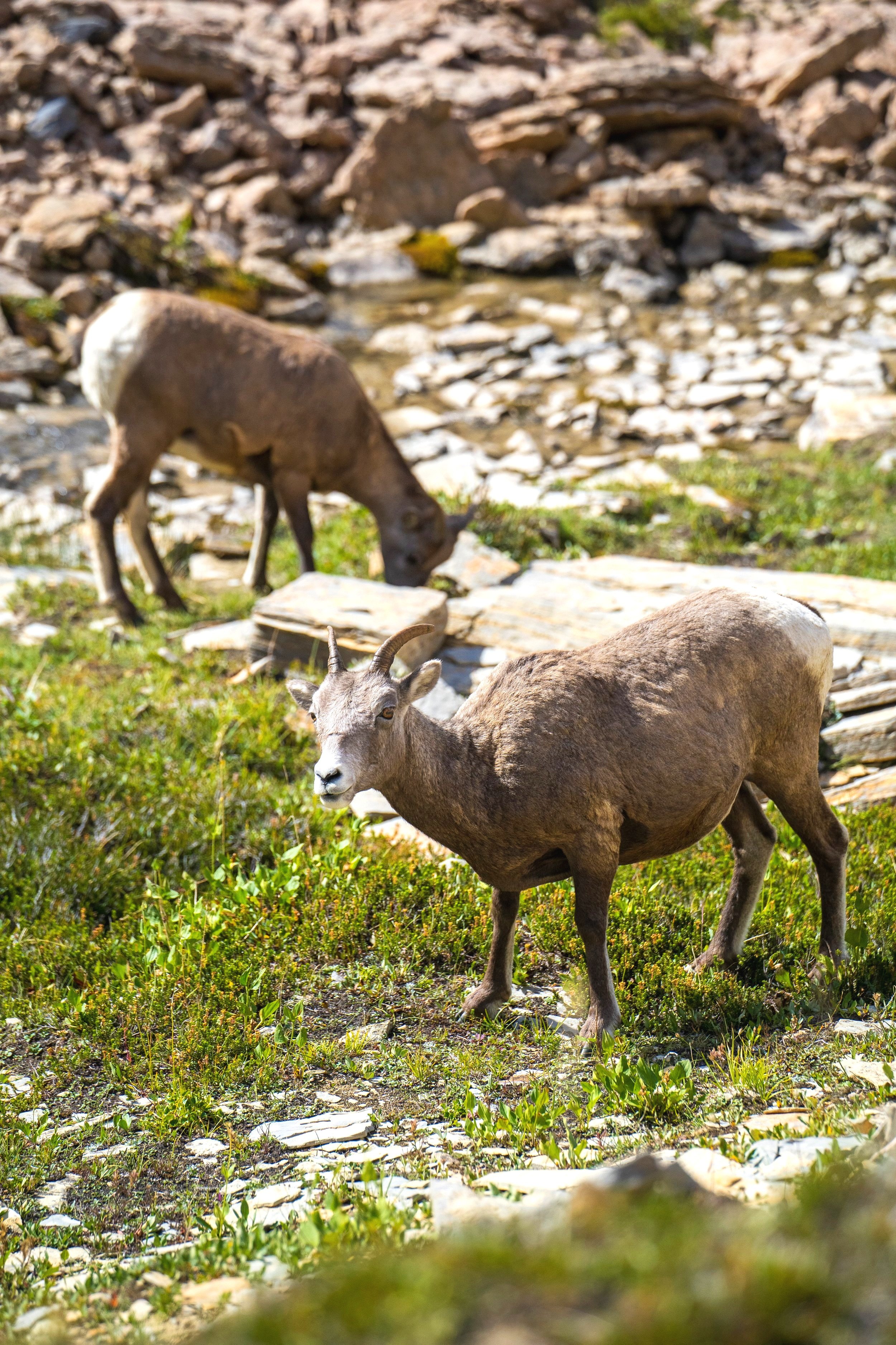
Bighorn Sheep
The last part of the Barnaby Alternate holds some beautiful memories.
We bagged some incredible peaks with fun trail registers (Fireball!) and met a large family of Bighorn Sheep after getting lost and trying to find our way back. Every down has an up…
Finally, the last cairn was in sight and a long, exposed descent led us to the three Barnaby Lakes. We greeted many hikers and fishers, and considered having a swim but went for a small dip instead. All the way down into the valley we crossed a road - the first sign of “civilization” - and disappeared into the woodlands. I remember eating thimbleberries until our fingers turned red, and filling up fresh water at Suicide Creek - scary, intriguing name. With relative ease, we climbed the hill and made our way on the relatively new trail into the dusk.
Day 7: Lynx Creek - Coleman (30 km)
The last day of the first section took us through cow country. Lynx Creek Campground (self-registration, +/- 21 CAD) had more cows than people in it. We ended up hiking in a bicycle race, which was really fun, since A) we were not the only ones suffering in the heat and B) we were sometimes faster going uphill and C) we had our first trail magic! A friend of one participant handed us Cokes and cookies and we were unbelievably grateful - trail magic is rare in the remote Rockies.
The last 10 km or so are ATV country. All drivers were very polite and immediately slowed down for us. Hiking, however, felt slow. After what seemed like an eternity, especially without four wheels, the first houses of Crowsnest Pass popped up in sight. Finally, we staggered into Coleman’s Subway and devoured one footlong (Chicken Teriyaki) each. We checked into our Airbnb and watched “Pretty Woman” until we fell asleep.
Interested in our GDT Gear Lists?
Coleman & accomodation
Finding a place to sleep in Coleman shouldn’t be too hard. For B&Bs, there are Safe Haven (We do not know if they will be open in 2023) and Country Encounters. The Paddock Inn is also a hiker’s favorite.
Section A: Complete!
Thanks for reading! Feel free to leave any questions or comments.